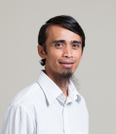
Curriculum vitae
======
Education
- 2011 – Ph.D. in Remote Sensing and Landscape Ecology, Institut Teknologi Bandung, Indonesia
- 2004 – M. Eng. in Remote Sensing, Institut Teknologi Bandung, Indonesia
- 2001 – B. Sc. in Ecology and Conservation, Universitas Padjadjaran, Indonesia
Area of Expertise
- Remote Sensing
- Landscape Ecology
- Free and Open Source GIS
Work experience
Jun – Nov 2020
Spatial Dynamics Expert
Client : Ministry of National Development Planning of the Republic of Indonesia
Main tasks delivered in the project were: (1) extracting land cover information from remote sensing datasets using Google Earth Engine, (2) modeling the spatial dynamics of land use land cover (LULC) and making LULC prediction for the year of 2035 and 2045, based on extracted LULC from remote sensing and existing GIS datasets.
Jun – Nov 2020
WebGIS Expert
Client : The Indonesia Investment Coordinating Board / BKPM
Main tasks delivered in the project were: (1) designing and developing the software architecture, (2) supervising the implementation of the WebGIS in BKPM for promoting the investment.
Sep – Des 2019
Remote Sensing Expert
Client : Indonesia Climate Change Trust Fund - Bappenas
Main tasks delivered in the project was analying remote sensing data (active and passive) to model the distribution of peatlands in Indonesia. The methods implemented to achieve the task were desktop-based processing using GRASS GIS and QGIS, cloud processing (Google Earth Engine, Machine Learning) dan geostatistic modeling using R.
Mar – June 2019
Geospatial System Specialist
Client : The World Bank
The main task is to implement a High Availability WebGIS Server based on PostgreSQL, GeoServer and Apache Tomcat server.
Jul 2016– Dec 2018
Remote Sensing Specialist
Client : Japan Aerospace and Exploration Agency (JAXA)
Activities performed were managing more than 20 Sentinel Asia / IDC activation with main activities such as communication with Data Provider and the End Users; download and upload remote sensing data; generating and dissemination of VAP.
Publications
1) Hadi, F., R. Febrianto. I. H. Ismullah, K. Wikantika and E.N. Megantara. 2012. Exploring ALOS PALSAR for Forest Structure Analyses of Javan Gibbon’s Habitat. Final Report on ALOS Application and Verification Project. 2nd Edition. Japan Aerospace Exploration Agency.
2) M. Ilham, F. Hadi, and K. Wikantika. Multi-regression Vegetation Index Approach to Estimate Carbon Stock in Bunga Rampai Penginderaan Jauh Indonesia. 2012. Ketut Wikantika and Lissa Fajri (eds). Center for Remote Sensing – Institut Teknologi Bandung. 2012. pp. 184 – 198.
3) R. Ragajaya, F. Hadi and K.Wikantika. 2012. Estimating Biomass with Polarimetric SAR Method using ALOS PALSAR in Bunga Rampai Penginderaan Jauh Indonesia. 2012. Ketut Wikantika and Lissa Fajri (eds). Center for Remote Sensing – Institut Teknologi Bandung. 2012. pp. 168 – 182.
4) Withaningsih, S., Parikesit, S. Okubo, F. Hadi and J. Iskandar. 2010. Spatial Analyses of Rare and Threatened Raptor Diversity : Empirical Base for Establishing Conceptual Framework and Policy Guidance in Biodiversity. Asian Raptors : Science and Conservation for Present and Future. Proceedings of the 6th International Conference on Asian Raptors. Ulaanbaatar, Mongolia: Asian Raptor Research and Conservation Network – Mongolian Ornithological Society – National University of Mongolia.
5) Hadi, F., D.M. Hakim, Y. Perdana, A. Hadiyana S. Darmawan, O. Mubarak, S. Nashrrullah and K. Wikantika. 2009. The Use of Spectral Library for Land Cover Classification with Satellite Imagery. The Second International Remote Sensing and Geographic Information Science Workshop Series on Demography, Land Use Land Cover and Disaster organized by Research Group of Remote Sensing and Geographic Information Science, Dept. of Geodesy and Geomatics, Institut Teknologi Bandung. Bandung. Indonesia.
